Information
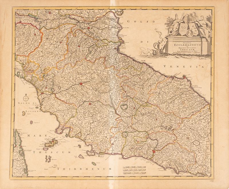
Copper engraving, ca. 1750. 53x66 cm. Second version of Seutter's map of the Tuscan Papal States, which follows the first by a few years. Small stains and reinforcement on the central fold. With passepartout.
Specialist Notes
This densely engraved map of central Italy is filled with details of cities, roads, rivers, archbishoprics, universities, and more. The map extends to include northern Corsica. The allegorical title cartouche fills the Adriatic Sea and depicts marine figures and putti surrounded by symbols of the papacy and the arts.
Contact
Condition report
To request a Condition Report, please contact libriestampe@finarte.it
The department will provide you with a general report of the condition of the property described above. Please note that what Finarte declares with respect to the state of conservation of the objects corresponds only to a qualified opinion and that we are not professional conservators or restorers.
We urge you to consult with a restorer or conservator of your choice who will be better able to provide a detailed, professional report. We always suggest prospective buyers to inspect each lot to satisfy themselves as to condition during the exhibition days as indicated in the catalog.
Suggested lots
Caricamento lotti suggeriti...
More Lots


244