Estimate
€ 280 - 400
Sold
€ 361
The price includes buyer's premium
Do you have a similar item you would like to sell?
Information
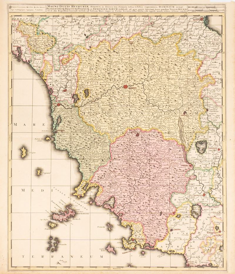
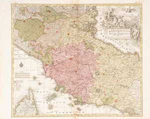
Colored copperplate engraving, Amsterdam, 1710, 61.5 x 52.5 cm. Map of the Grand Duchy of Tuscany published in the early eighteenth century by Gerard and Leonard Valk and included in their Atlantis sylloge compendiosa or nova totius Geographia . With passepartout.
Specialist Notes
Graphics characterised by a wealth of toponyms, but with poor orography, typical of Valk's production, with the absence of a title block, which is moved up between the explanations of the graphic signs for the inhabited centres and the scales of thousands, and by the absence of decorative elements.
Contact
Suggested lots
Caricamento lotti suggeriti...
More Lots
202
Seutter, Matthaeus
Status Ecclesiae et Magni Ducatus Hetruriae, 1735 approx.
Estimate € 200 - 300
Starting bid € 200