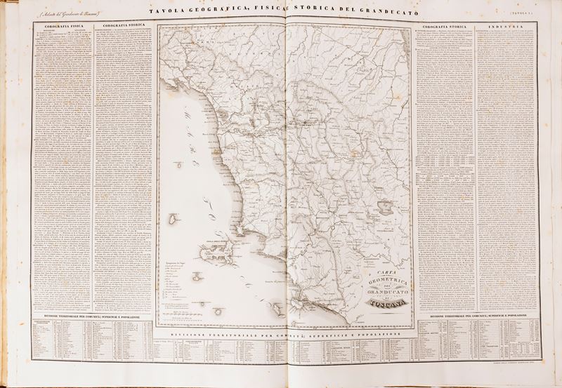
237
Zuccagni Orlandini, Attilio
Physical and Historical Geographical Atlas of the Grand Duchy of Tuscany, 1832
Estimate
€ 120 - 140
Sold
€ 710
The price includes buyer's premium
Do you have a similar item you would like to sell?
Information
Florence, in the Granducale Printing House, 1832. Maximum folio, 538 x 750 mm. mm. Title page and 20 double-page plates with large geographical maps in the centre, surrounded by text in two columns, brown marbled cardboard, peelings. United modern edition of the same, printed by the Cassa di Risparmio di Pistoia and Pescia in 1974.
Specialist Notes
MONUMENTAL ATLAS OF THE GRAND DUCHY OF TUSCANY. The text around each map analyzes Physical Chorography, Historical Topography, Industry, Territorial division by community subdivision by parishes; area and population, weekly markets, annual fairs in each locality of the Grand Duchy of Tuscany. The tenth, which is the topographic, physical and historical table of the city of Florence, with a map of Florence.
Contact
Suggested lots
Caricamento lotti suggeriti...
More Lots

238