Estimate
€ 300 - 350
Sold
€ 361
The price includes buyer's premium
Do you have a similar item you would like to sell?
Information
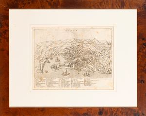
59 x 49
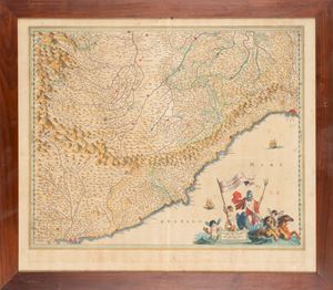
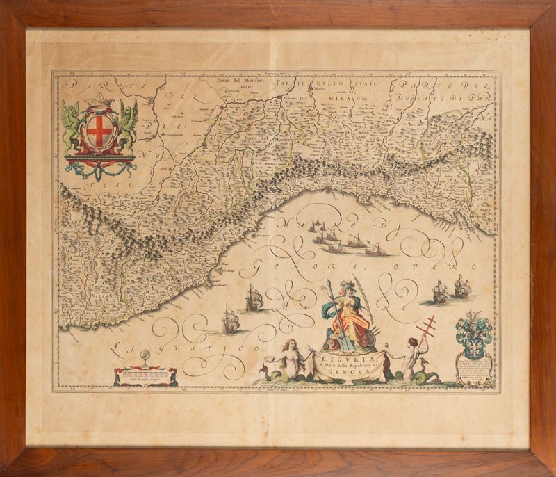
Geographical map included in the Atlas Major of Blaeu. Geographically it derives from the map of Magini, it presents a sumptuous cartouche surrounded by groups of ships and tritons, at the top left the coat of arms of the city of Genoa supported by two griffins, at the bottom left the armillary sphere with a scale of nautical miles, instead at the bottom right a dedication to Pietro Hasselaer. Copper engraving, contemporary coloring.
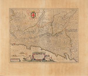
Geographical map included in the Atlas Major of Blaeu. Geographically it derives from the map of Magini, it presents a sumptuous cartouche surrounded by groups of ships and tritons, at the top left the coat of arms of the city of Genoa supported by two griffins, at the bottom left the armillary sphere with a scale of nautical miles, instead at the bottom right a dedication to Pietro Hasselaer. Copper engraving, contemporary coloring.
Contact
Suggested lots
Caricamento lotti suggeriti...