Information
49 x 33
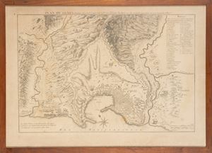
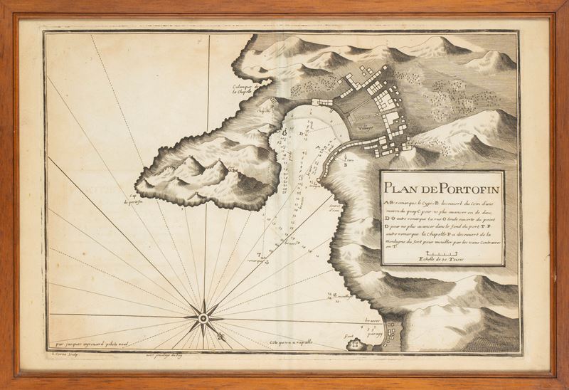
Nautical chart showing the stretch of coast between the Cape of Portofino and the Bay of Paraggi. Considered one of the oldest printed representations of the town; along the coast you can see the bathymetric indications.
Nautical chart showing the stretch of coast between the Cape of Portofino and the Bay of Paraggi. Considered one of the oldest printed representations of the town; along the coast you can see the bathymetric indications.
Contact
Condition report
To request a Condition Report, please contact libriestampe@finarte.it
The department will provide you with a general report of the condition of the property described above. Please note that what Finarte declares with respect to the state of conservation of the objects corresponds only to a qualified opinion and that we are not professional conservators or restorers.
We urge you to consult with a restorer or conservator of your choice who will be better able to provide a detailed, professional report. We always suggest prospective buyers to inspect each lot to satisfy themselves as to condition during the exhibition days as indicated in the catalog.
Suggested lots
Caricamento lotti suggeriti...