Estimate
€ 20 - 100
Sold
€ 79
The price includes buyer's premium
Do you have a similar item you would like to sell?
Information
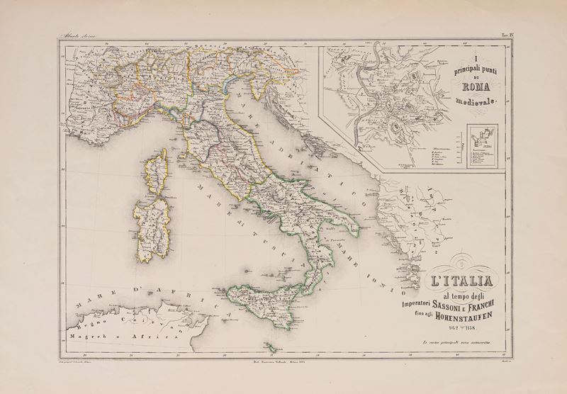
Lithograph with watercolored outlines of the States, 1868, sheet size: 60.2 x 42 cm (engraved portion, excluding edges: 33.6 x 47.2 cm). In good condition.
Specialist Notes
Map from the Atlas edited by FRANCESCO VALLARDI and printed by the Oscar Dressler Geographia in Milan (ANTIQUE ATLAS, plate no. 4). Detail inside the engraving depicting the main landmarks of medieval Rome.
Contact
Suggested lots
Caricamento lotti suggeriti...