Information
48 x 36
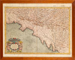
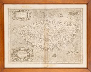
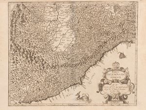
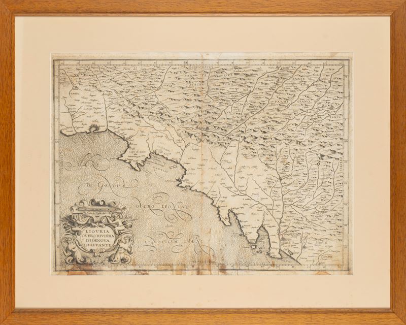
Very rare map depicting the eastern coast of Genoa between Sestri and the Magra River. Drawn by Magini in 1597, it derives from unpublished cartographic materials and is the FIRST REPRESENTATION OF LIGURIA . Engraved by Arnoldo di Arnoldi, it is a first version of the map never published in the Magini Atlas . Marginal browning in the lower part.
Very rare map depicting the eastern coast of Genoa between Sestri and the Magra River. Drawn by Magini in 1597, it derives from unpublished cartographic materials and is the FIRST REPRESENTATION OF LIGURIA . Engraved by Arnoldo di Arnoldi, it is a first version of the map never published in the Magini Atlas . Marginal browning in the lower part.
The table was published in 1597 in Bologna but was later redrawn by the Bolognese cartographer to fill obvious gaps and imperfections, attributable to the scarce and incomplete cartographic sources in Magini's possession at the time.
Contact
Condition report
To request a Condition Report, please contact libriestampe@finarte.it
The department will provide you with a general report of the condition of the property described above. Please note that what Finarte declares with respect to the state of conservation of the objects corresponds only to a qualified opinion and that we are not professional conservators or restorers.
We urge you to consult with a restorer or conservator of your choice who will be better able to provide a detailed, professional report. We always suggest prospective buyers to inspect each lot to satisfy themselves as to condition during the exhibition days as indicated in the catalog.
Suggested lots
Caricamento lotti suggeriti...