Estimate
€ 50 - 100
Aggiudicato
Current bid Starting bid
€ 50
Your offer is the highest Your bid doesn't meet the reserve price La tua offerta è stata superata(0 bids, reserve not met)
At auction on Thursday 25 June 2026 at 10:30
Information
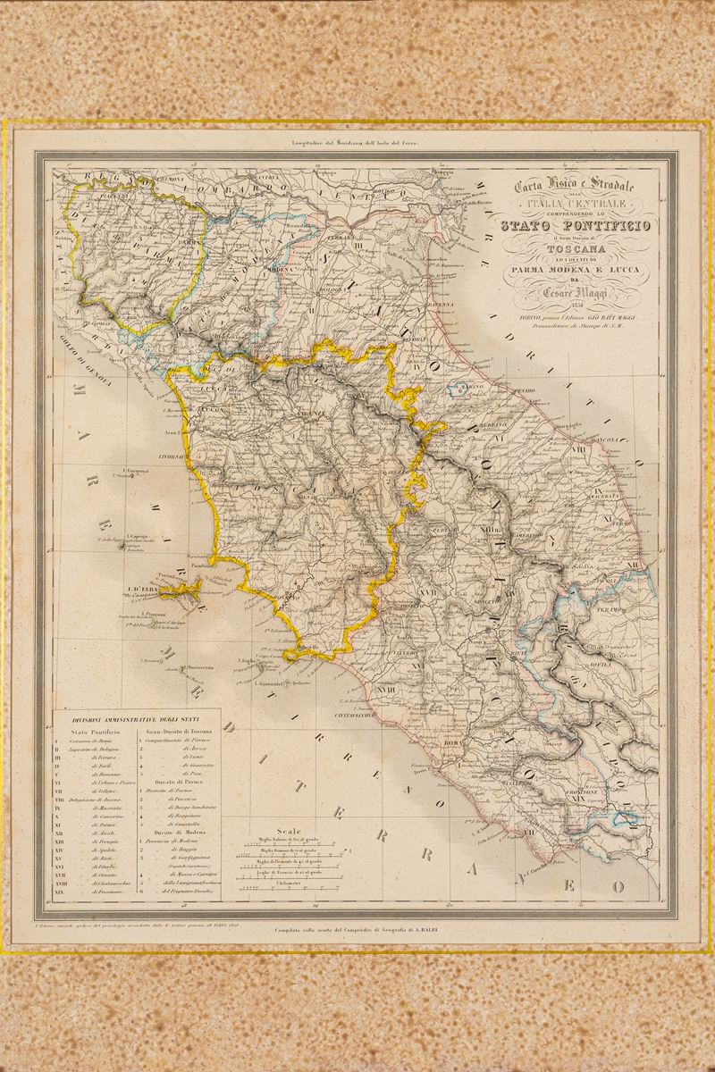
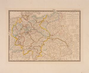
Map, Turin 1854, engraved and watercolored along the edges, engraved part 36 x 43 cm (entire sheet with margins 60 x 43 cm). Very light marginal browning but overall in good condition - Framed in dark wood (size 55 x 65 cm).
Specialist Notes
Map belonging to the UNIVERSAL ATLAS OF ANCIENT AND MODERN GEOGRAPHY compiled on the basis of the best astronomical documents and the discoveries of the most recent explorers by MAGGI E CASSELLA with the assistance of the Compendium of Geography by Adriano Balbi
Contact
Condition report
To request a Condition Report, please contact libriestampe@finarte.it
The department will provide you with a general report of the condition of the property described above. Please note that what Finarte declares with respect to the state of conservation of the objects corresponds only to a qualified opinion and that we are not professional conservators or restorers.
We urge you to consult with a restorer or conservator of your choice who will be better able to provide a detailed, professional report. We always suggest prospective buyers to inspect each lot to satisfy themselves as to condition during the exhibition days as indicated in the catalog.
Suggested lots
Caricamento lotti suggeriti...
More Lots
164
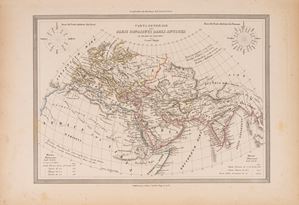
General map of the countries known to the Ancients at the time of Ptolemy, 1848
Estimate € 50 - 100
Starting bid € 50
165
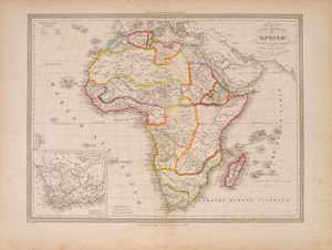
General map of Africa according to the latest discoveries, 1852
Estimate € 20 - 100
Starting bid € 10
166
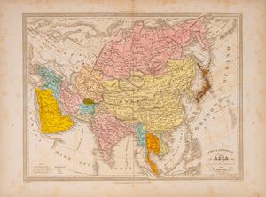
General map of Asia according to its latest divisions, 1851
Estimate € 20 - 100
Starting bid € 10
167