Estimate
€ 20 - 100
Aggiudicato
Current bid Starting bid
€ 10
Your offer is the highest Your bid doesn't meet the reserve price La tua offerta è stata superata(0 bids, reserve not met)
At auction on Thursday 25 June 2026 at 10:30
Information
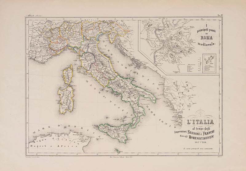
Lithograph with watercolored outlines of the States, 1868, sheet size: 60.2 x 42 cm (engraved portion, excluding edges: 33.6 x 47.2 cm). In good condition.
Specialist Notes
Map from the Atlas edited by FRANCESCO VALLARDI and printed by the Oscar Dressler Geographia in Milan (ANTIQUE ATLAS, plate no. 4). Detail inside the engraving depicting the main landmarks of medieval Rome.
Contact
Condition report
To request a Condition Report, please contact libriestampe@finarte.it
The department will provide you with a general report of the condition of the property described above. Please note that what Finarte declares with respect to the state of conservation of the objects corresponds only to a qualified opinion and that we are not professional conservators or restorers.
We urge you to consult with a restorer or conservator of your choice who will be better able to provide a detailed, professional report. We always suggest prospective buyers to inspect each lot to satisfy themselves as to condition during the exhibition days as indicated in the catalog.
Suggested lots
Caricamento lotti suggeriti...
More Lots
214
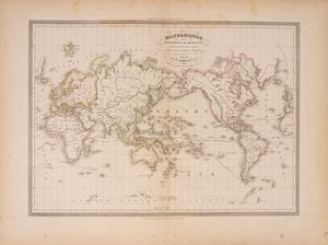
World map on the Mercator projection showing the routes followed by Diaz, Gama, Columbus and..., 1850
Estimate € 50 - 100
Starting bid € 50
