


Information
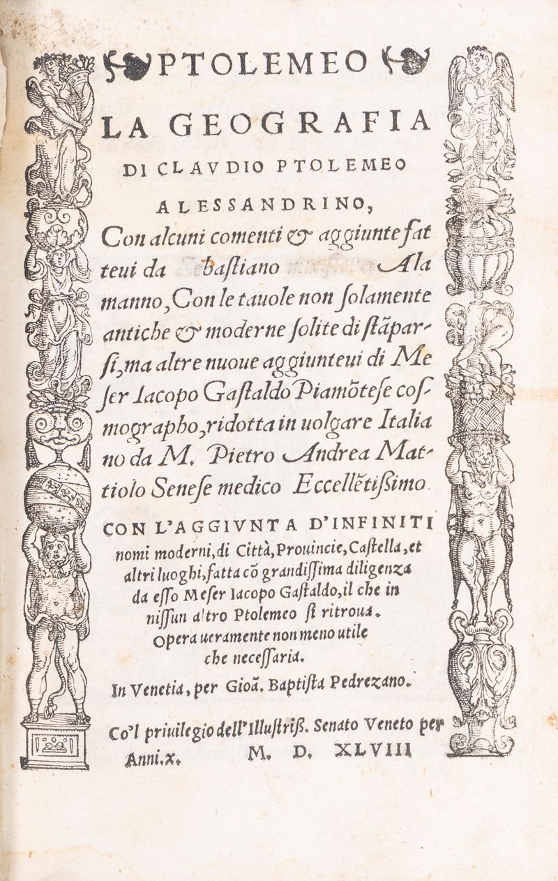
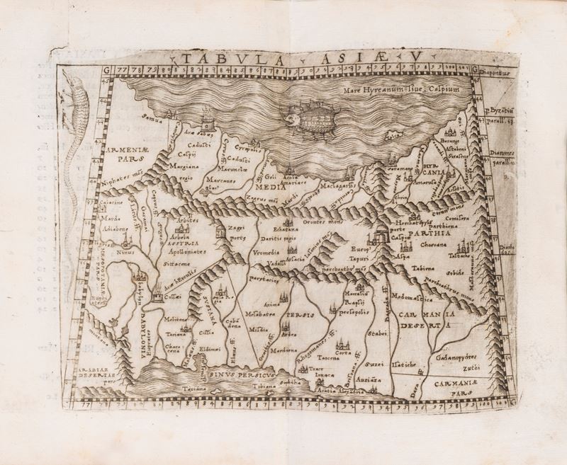
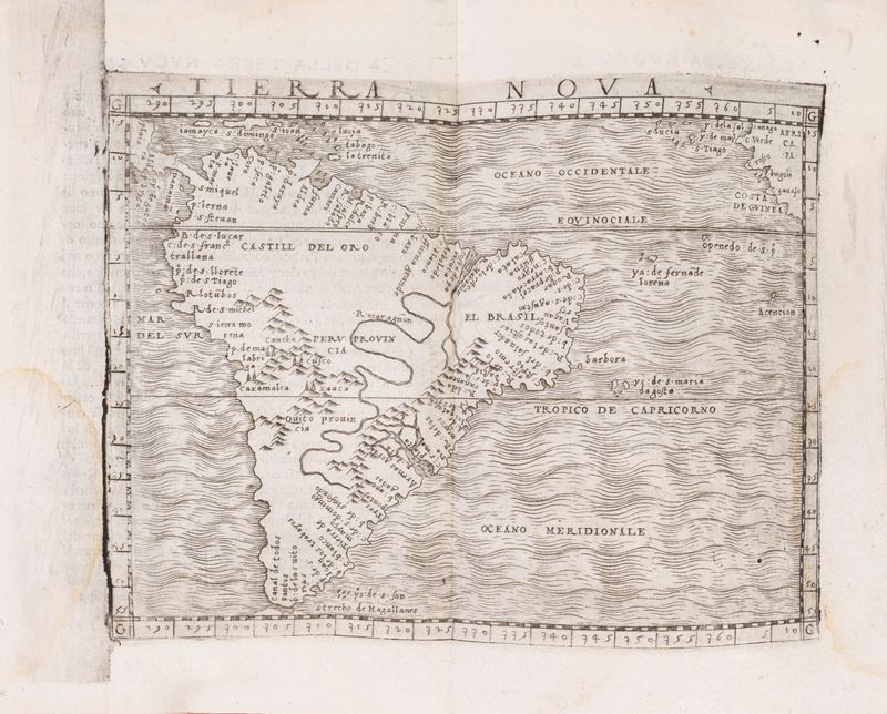
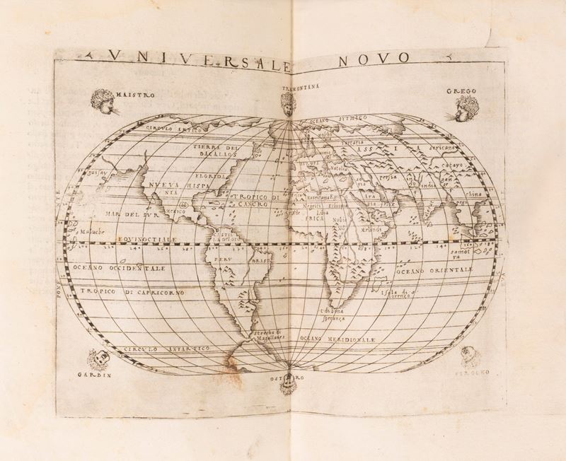
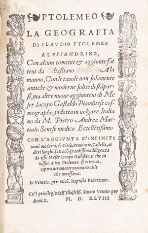
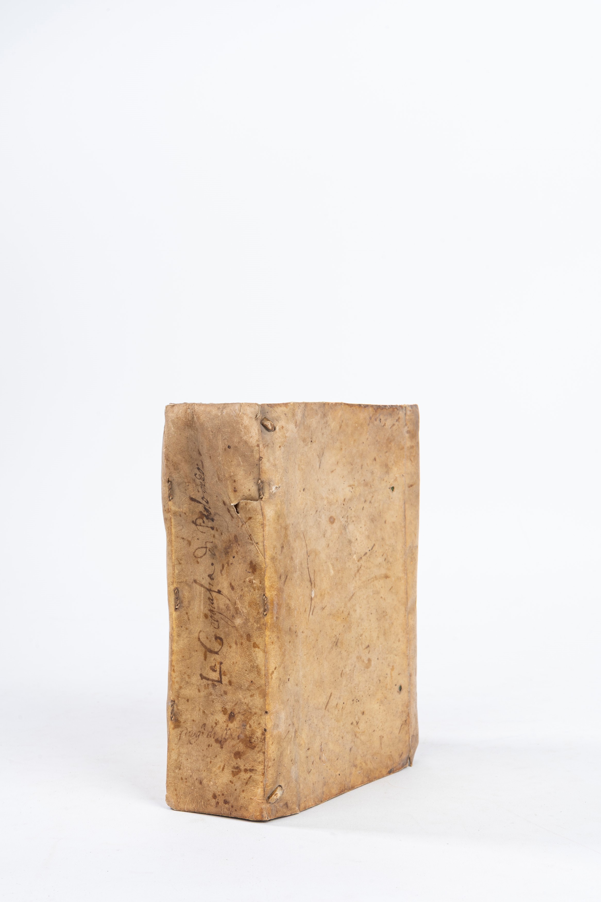
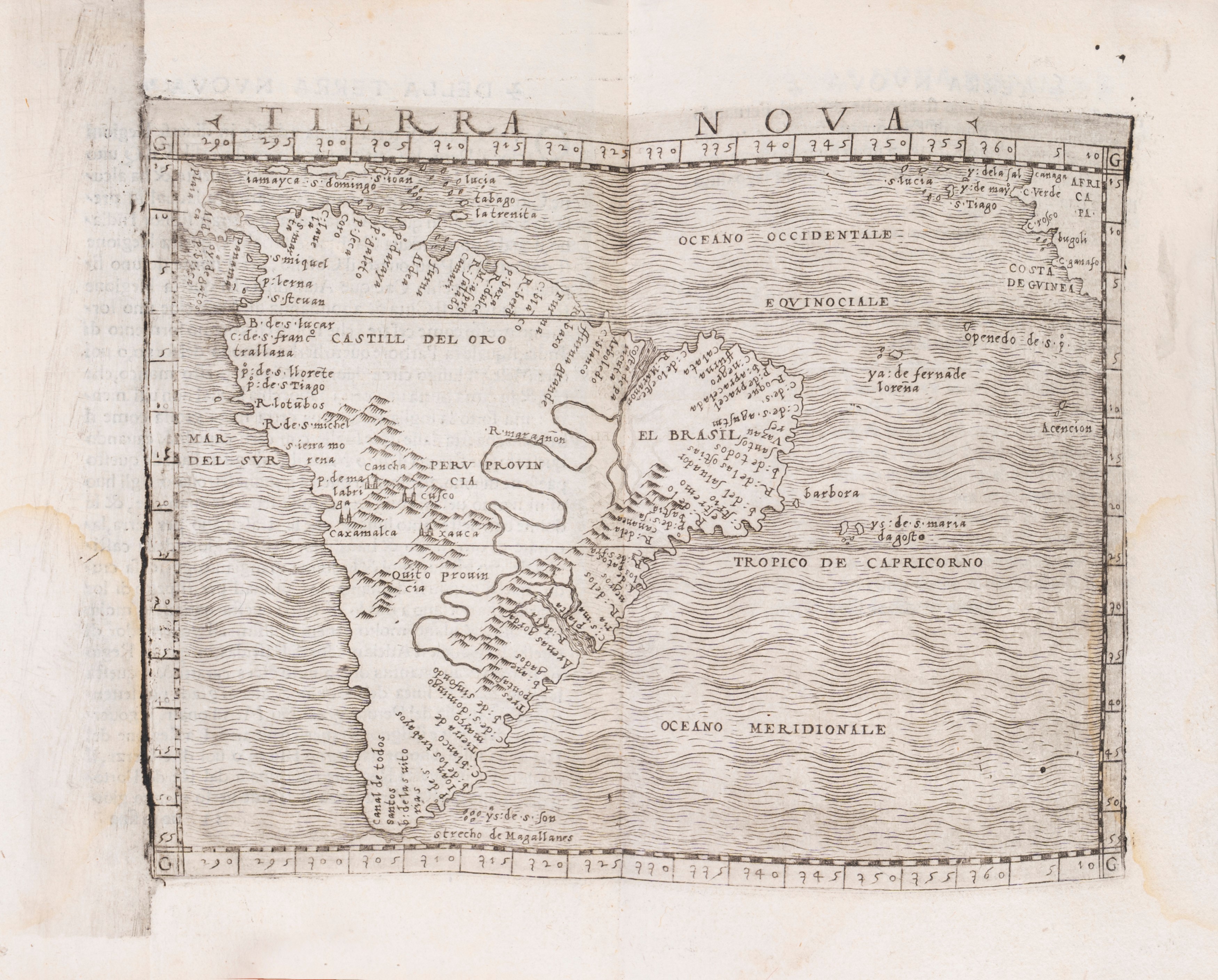
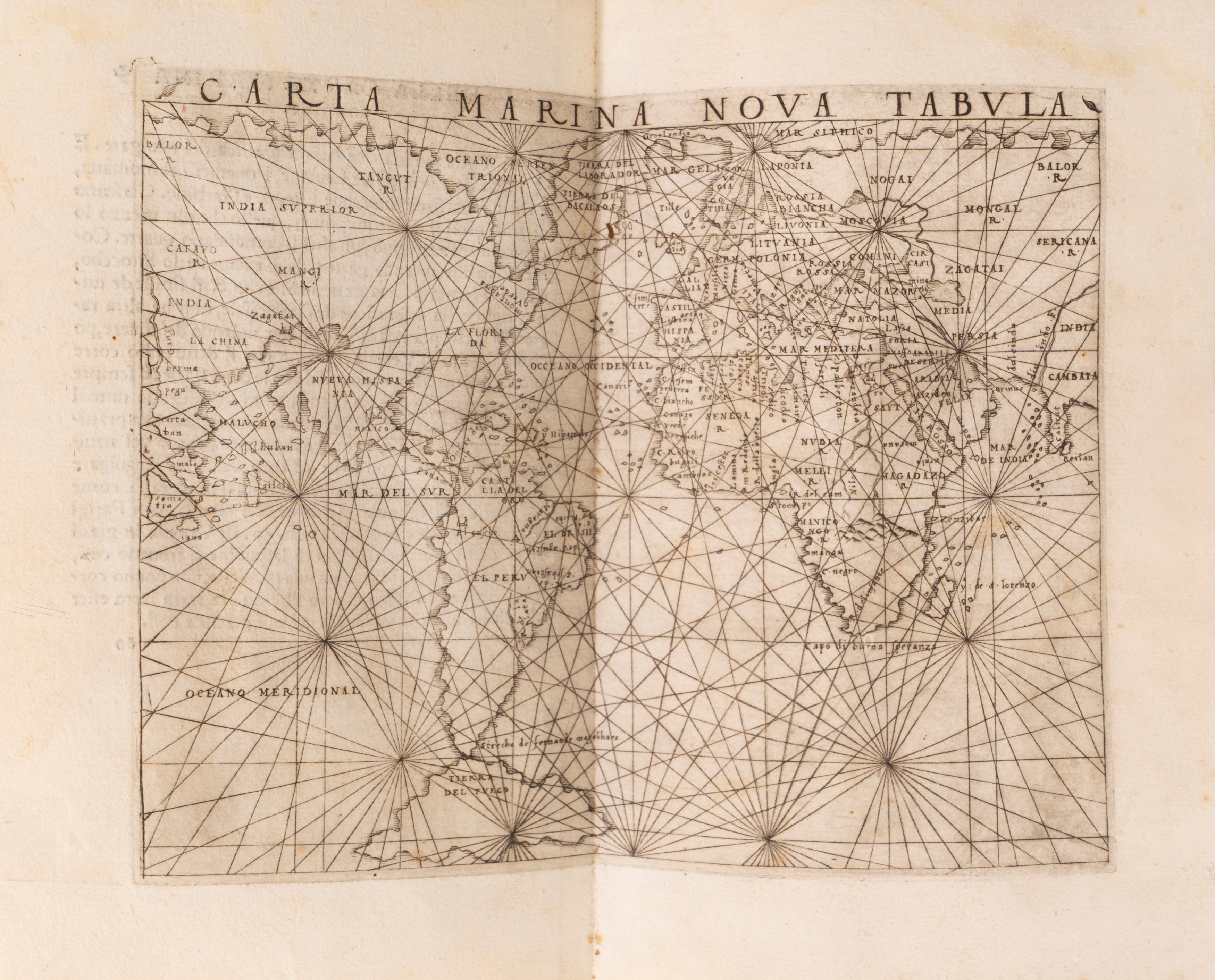
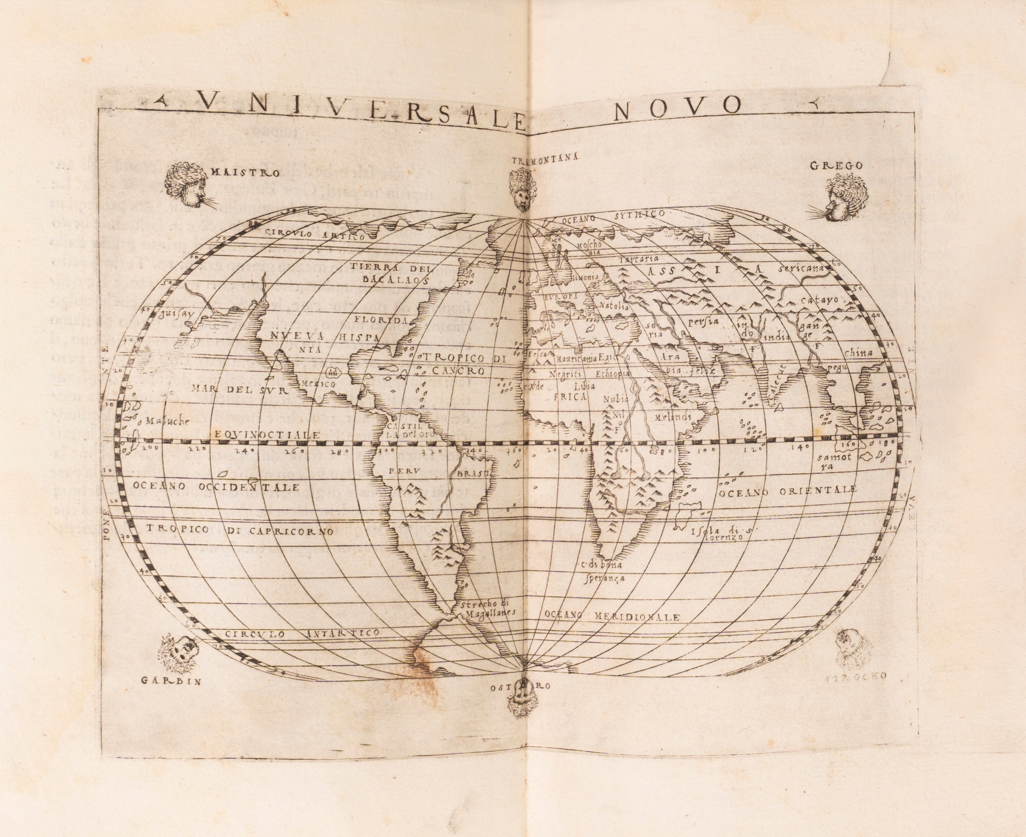
Venice, Giovan Battista Pedrezano (for Nicolò Bascarini), 1548 [October 1547]. In 8°. 172 x 116mm. Title page within two allegorical borders, portrait of Ptolemy, dedication to Leone Strozzi, epistle To the Readers , Addition by Sebastiano Munstero ..., How Geography is different from Cosmography , Interpretation of some words , First book of Geography...these are the things it contains , Table of the Regions, Peoples, Cities, Mountains, Rivers ...at the end of the table the typographical mark, The First Book of Clausius Ptolemy - The Eighth Book , Register and typographical mark, 43 DOUBLE-PAGE TABLES (out of 60) depicting Europe, Asia, Africa and the New World, including the New Land, the New Spain, the New Land of Bacalos, the Island of Cuba, the New Spanish Island, the New Universal and the New Carta Marina , contemporary binding in loose parchment, tears and defects, handwritten title on the spine.
Specialist Notes
First complete edition in Italian, first octavo edition .
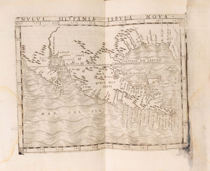
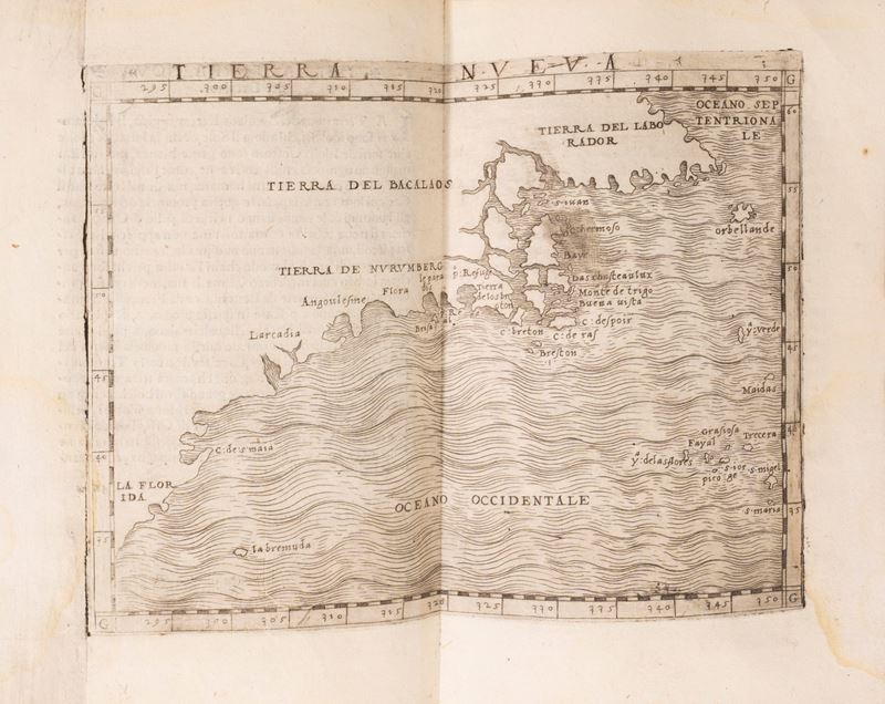
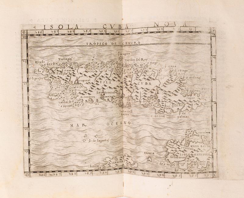
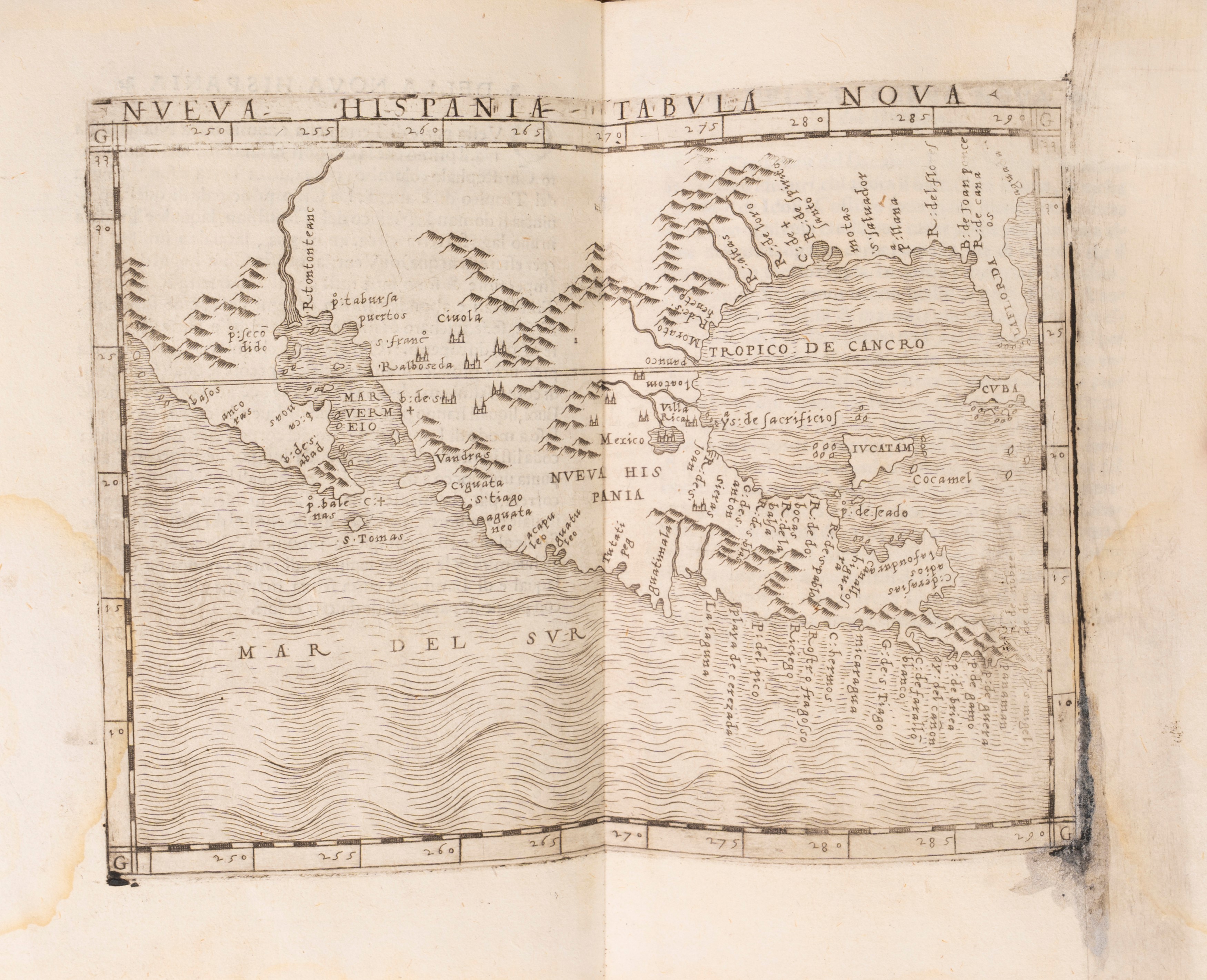
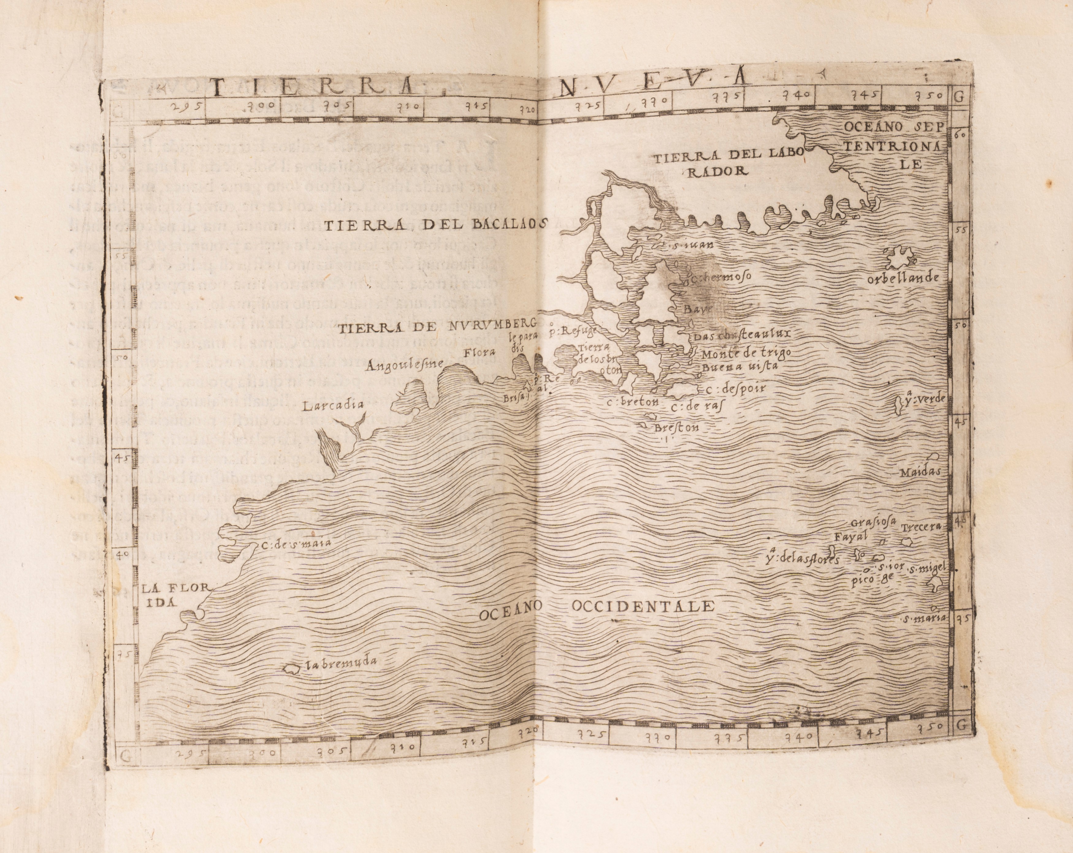
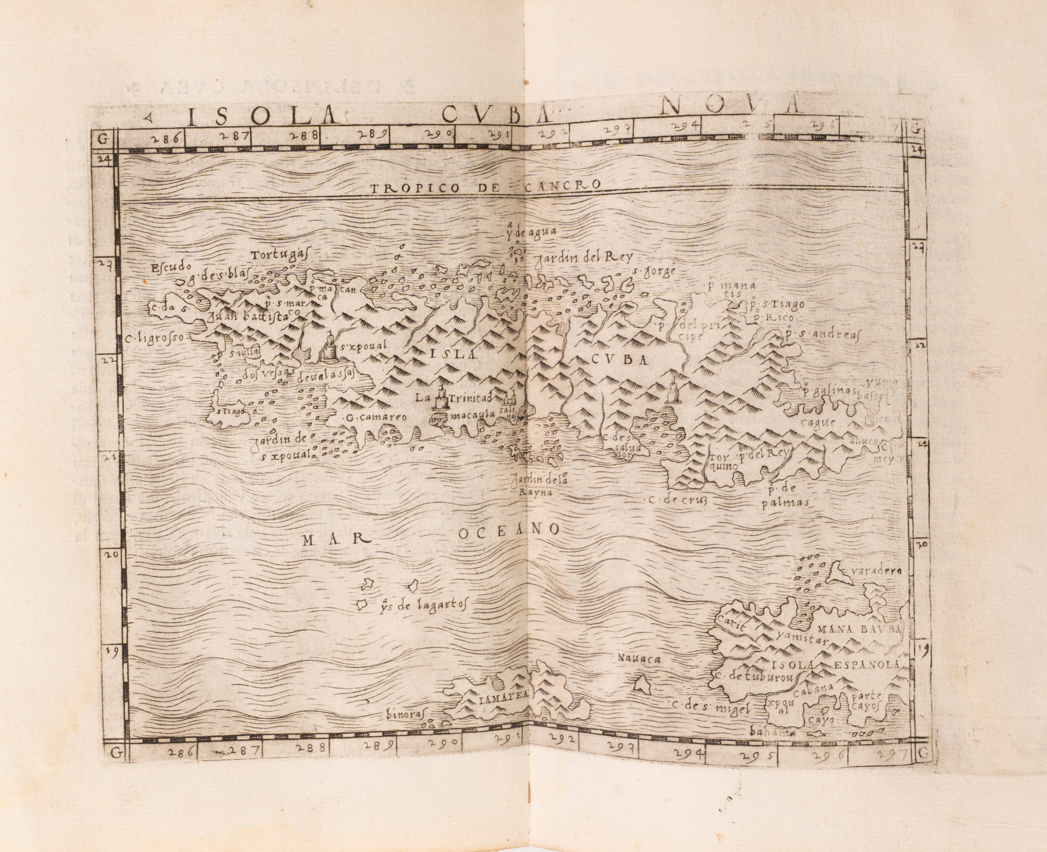
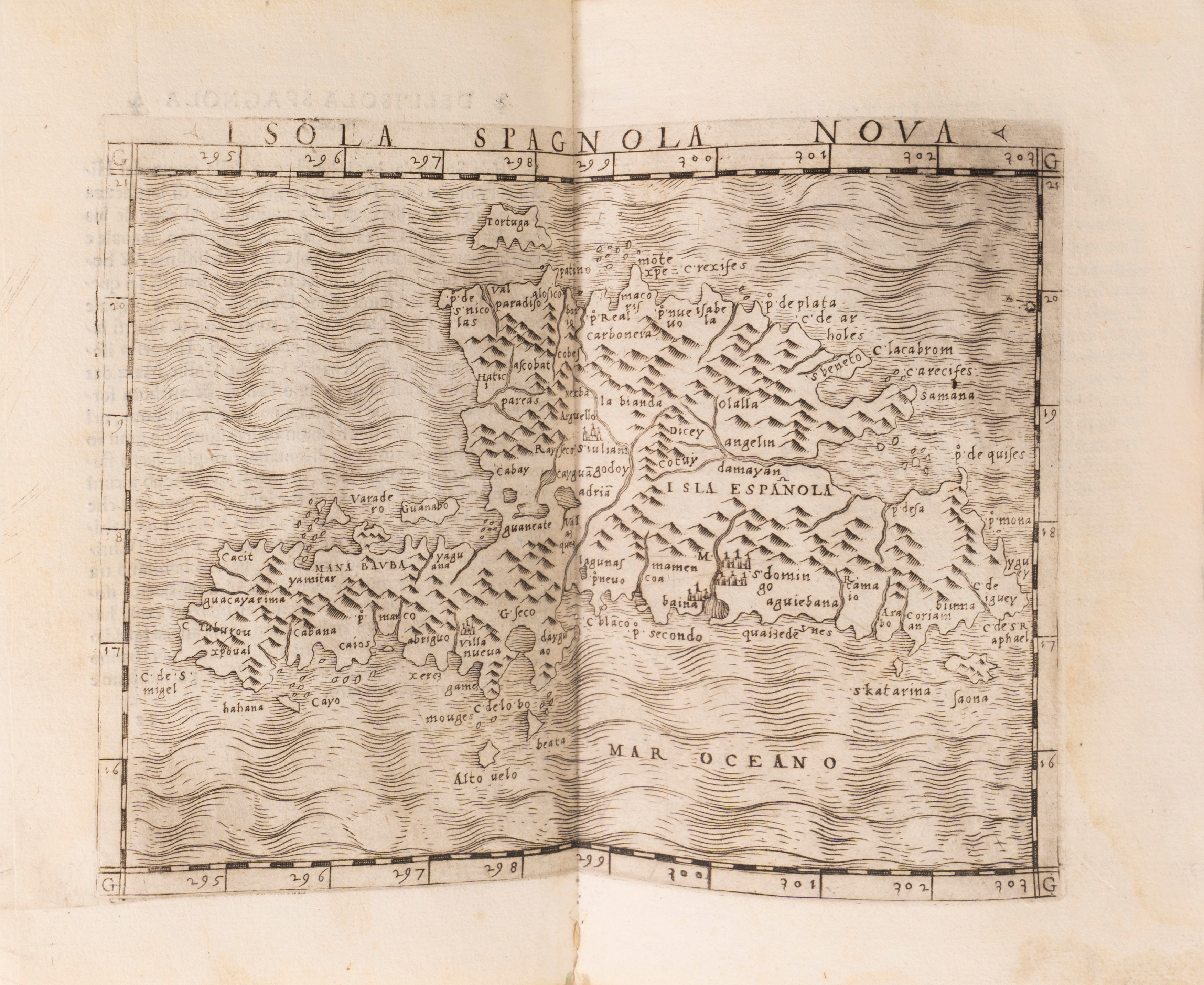
The 1548 edition of Ptolemy (colophon dated October 1547) differs from its predecessors in several respects. It is the first “pocket” edition of the work, making it at least plausible that it accompanied an explorer. Sebastian Münster’s commentary – a truly pan-European humanistic effort – and Ptolemy’s text were both translated by Pietro Andrea Mattioli (Matthioli), best known as a botanist and translator of Dioscorides. Gastaldi’s maps – who was also responsible for updating and adding modern place names, a massive task reflected in the 127-page index – are unusually decorative and up-to-date, especially considering their small size. There is a large group of non-European maps, with a focus on the Silk Road and India (maps 46–53) and 5 maps of the Americas, including the first regional maps of North America. (The two world maps (one of which is a nautical chart) show the modern turn in world representation. Both continue to conceptualize America as connected to Asia, even as the globe itself begins to conceive of a caesura between northwest America and northeast Asia.
The 1548 edition of Ptolemy (colophon dated October 1547) differs from its predecessors in several respects. It is the first “pocket” edition of the work, making it at least plausible that it accompanied an explorer. Sebastian Münster’s commentary – a truly pan-European humanistic effort – and Ptolemy’s text were both translated by Pietro Andrea Mattioli (Matthioli), best known as a botanist and translator of Dioscorides. Gastaldi’s maps – who was also responsible for updating and adding modern place names, a massive task reflected in the 127-page index – are unusually decorative and up-to-date, especially considering their small size. There is a large group of non-European maps, with a focus on the Silk Road and India (maps 46–53) and 5 maps of the Americas, including the first regional maps of North America. (The two world maps (one of which is a nautical chart) show the modern turn in world representation. Both continue to conceptualize America as connected to Asia, even as the globe itself begins to conceive of a caesura between northwest America and northeast Asia.
Contact
Condition report
To request a Condition Report, please contact libriestampe@finarte.it
The department will provide you with a general report of the condition of the property described above. Please note that what Finarte declares with respect to the state of conservation of the objects corresponds only to a qualified opinion and that we are not professional conservators or restorers.
We urge you to consult with a restorer or conservator of your choice who will be better able to provide a detailed, professional report. We always suggest prospective buyers to inspect each lot to satisfy themselves as to condition during the exhibition days as indicated in the catalog.
Suggested lots
Caricamento lotti suggeriti...
More Lots

132
Varchi, Benedetto
The second part of the lessons of M. Benedetto Varchi, 1561
Estimate € 220 - 240
Starting bid € 220

135