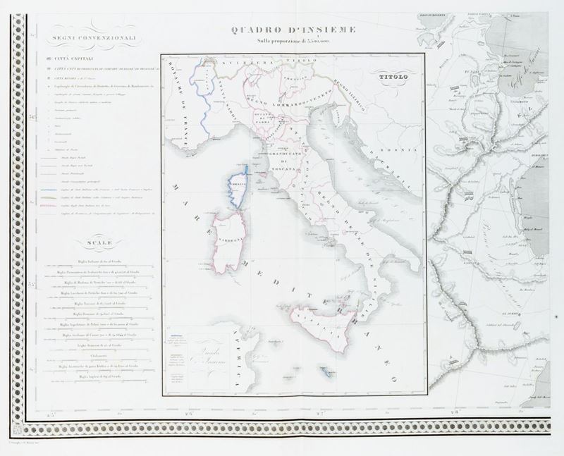
234
Cartografia - Atlante
Zuccagni Orlandini, Attilio
Illustrative atlas, that is, a collection of the main ancient, medieval and modern Italian monuments and some pictorial views, 1845
Estimate
€ 500 - 1.000
Sold
€ 1.088
The price includes buyer's premium
Do you have a similar item you would like to sell?
Information
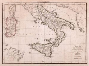
Florence, 1845. In 2nd. Three title cards, 1 text card, followed by 134 plates engraved in copper and signed in the plate by the engravers and designers, of which 131 geographical maps, many of which folded and in coeval coloring, 3 tables with coats of arms, finally 3 index cards , reddening, slight blooms and some water gora, binding of the century. XIX, defects and shortcomings. & Nbsp; & nbsp;
Specialist Notes
Composite atlas that includes a table of Italian Switzerland, of the Papal State, & nbsp; of the Lombard Veneto Kingdom and the Kingdom of the Two Sicilies. Attilio Zuccagni Orlanidini was a geographer and statistician, born in Fiesole in July 1784, who died in Florence on November 25, 1872. From the first Atlas centered on Tuscany (1828-'32), I came to the idea of extending his graphic illustration to descriptive all of Italy within its natural borders, a work whose publication I announced in 1835 and which was completed in 1845. The lot is sold as a collection of tables and is not liable to return.
Contact
Suggested lots
Caricamento lotti suggeriti...
More Lots
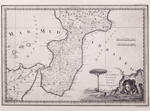
235
Cassini, Giovanni Maria
Further Calabria - The Kingdoms of Naples and Sicily, 1790
Estimate € 120 - 160
Starting bid € 120
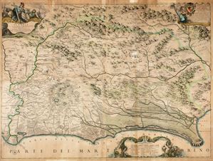
236
Ameti , Giacomo Filippo
Lazio with its most conspicuous ancient and modern roads and main farmhouses, and its estates, 1693
Estimate € 1.200 - 2.000
Starting bid € 1.200
237